
TX Redistricting - What does 'The One Big Beautiful Map' of Texas Look Like?
Imaginary Borders with Real Implications

In the summer of 2025, the Texas Senate approved a bill in a special session — a mid-decade redistricting of the state’s 38 congressional districts. This is rare - districts are normally redrawn once per decade after the Census to account for population changes.
On Monday, the US Supreme Court ruled that this new Texas redistricting map would be allowed, meaning the boundaries of each of the US House Districts in Texas will be different for the rest of the decade. Governor Abbott called it The One Big Beautiful Map. So what changes were made?
Map - Old (left) vs. New (right) Boundaries
(apologies to Gen Z, these maps are best viewed on an actual computer):

There are 435 total seats in the US House that can flip votes for America (again, TX now has 38 of the 435). Which means Texas now has 40 electoral votes for president (38 + 2 senators). We’re second only to California’s 54 (CA is down from 55 before 2020).
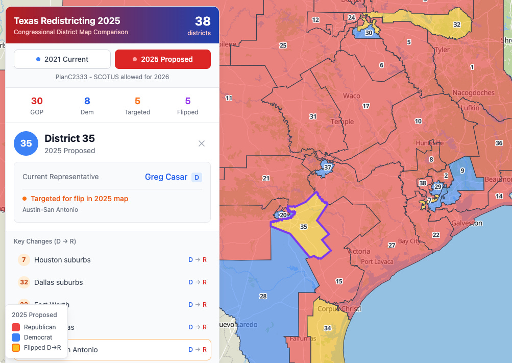
Below is the current Texas map (as of the last election) - 25 of the 38 seats are Republican. Still, Trump asked Texas to try and flip 5 additional seats to the GOP mid-decade to give Republicans an advantage in the US House. So expect it to be even more red after these latest boundary changes.
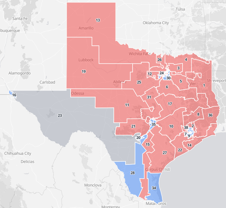
But now liberal states are responding and doing the exact same thing. So…like many things in politics, it may be a bunch of yapping and work that changes absolutely nothing. We’ll see.
Compare District Boundary Changes One at a Time:
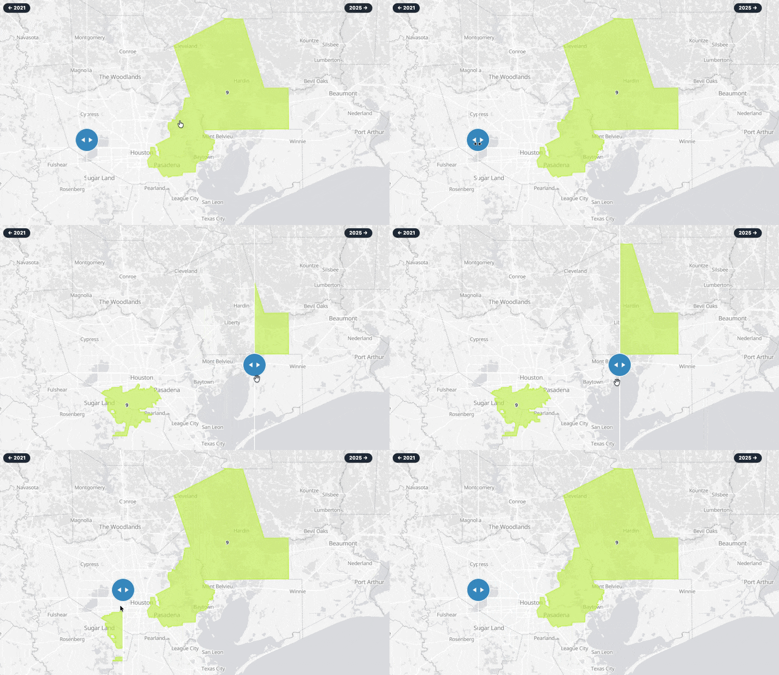
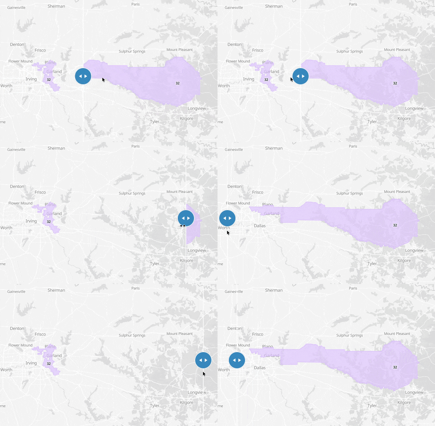
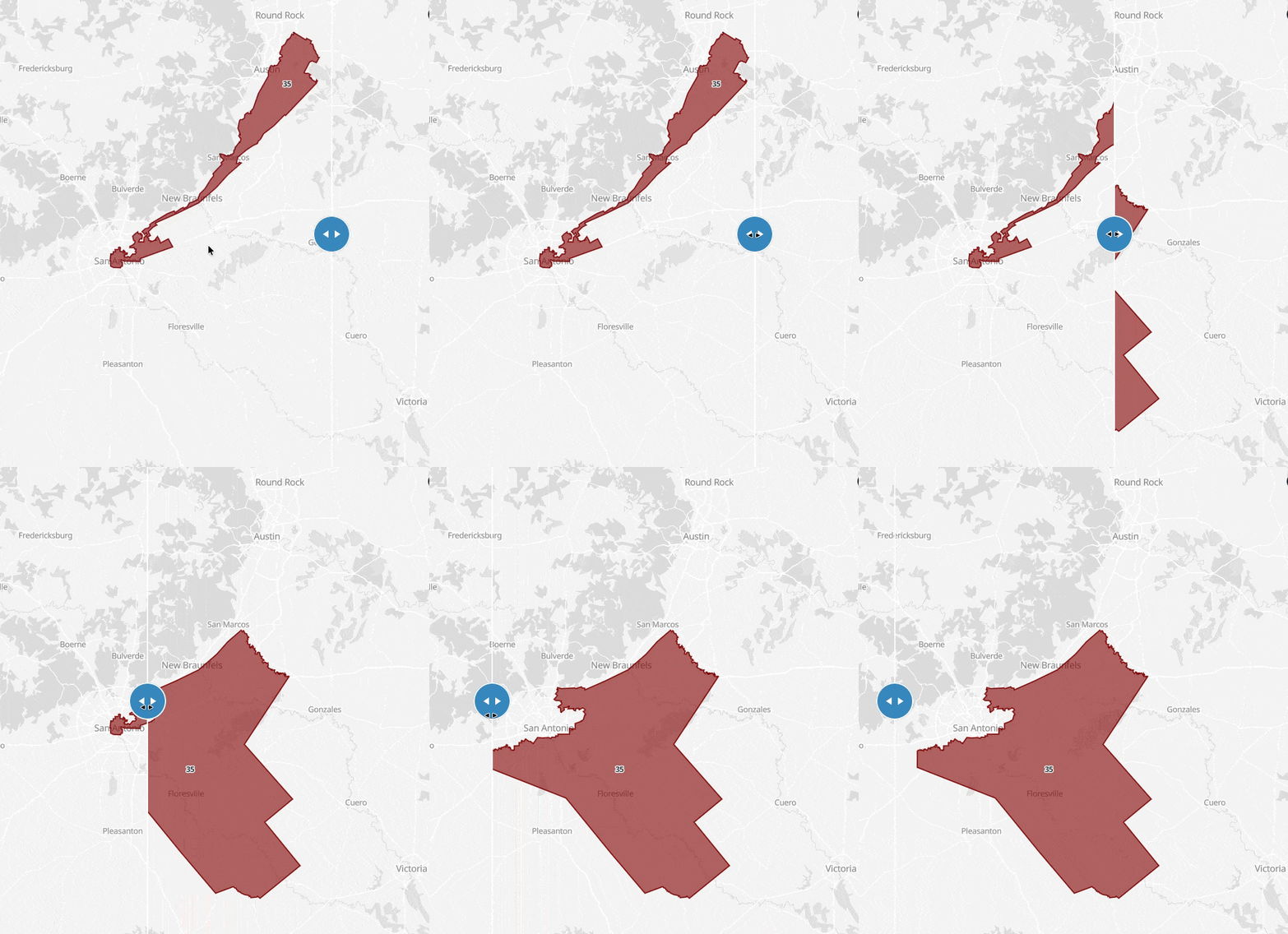
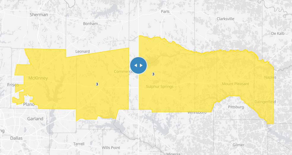
I have made a map here where you can look at each district individually and see how the boundaries have changed. You can see the changes more clearly this way.
District 9
District 32
Here’s a good Dallas Morning News Article on the changes in District 32: Texas redistricting divides North Dallas neighborhood, leaves some residents wondering why
District 35
District 3
Which 5 Districts might flip from D→R?
Map Highlighting Changes in 7, 32, 33, 34, 35:
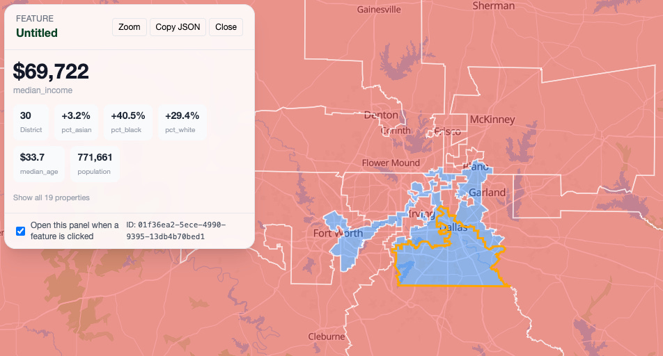
Demographics of Current Boundaries:
This is a map of the current boundaries with some demographic information for each. I can’t do the new boundaries because that census data hasn’t been released.
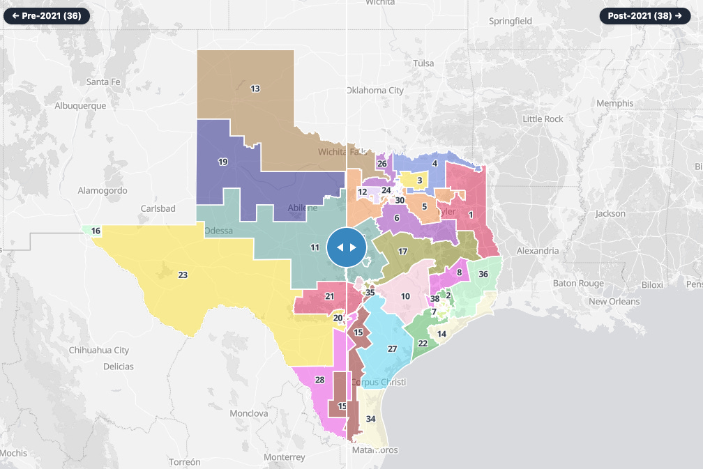
2020 Census Changes - Change from 36 to 38 Districts:
Previous Change (from Pre-2020 to Post 2020):
Implications
My personal take - we’ve now created an arms race where every state is going to start doing this over and over again to counteract the other states that are doing it. And each state will become more homogenized in the US House, ie - there won’t be any conservative districts in California or any Democratic districts in Texas.
So each conservative state gets more conservative and each liberal state gets more liberal, further dividing an already divided country.