
What does the largest aquifer in the US mean for Texas?
It supplies 1/3 of the states water

Aquifer is a great word, even if I’m not sure what it means. Here’s a definition. It’s apparently something like an underground lake, and they’re extremely important because they feed our water needs in America. There are several large ones across the world, but the largest one in the United States is called the Ogallala Aquifer (or High Plains Aquifer). Seen here:
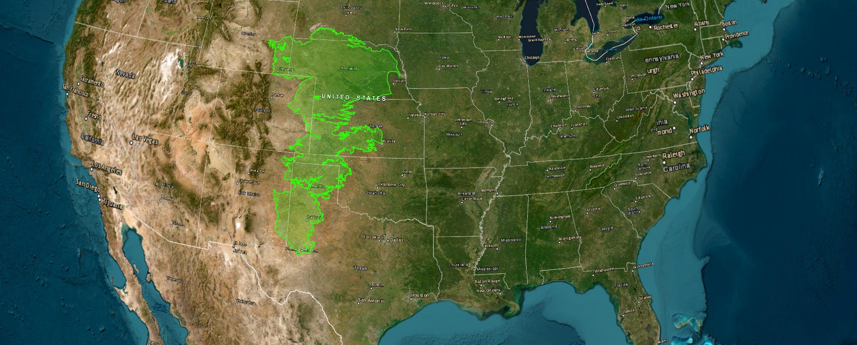
U.S. Geological Survey, Digital map of aquifer boundary for the High Plains aquifer in parts of Colorado, Kansas, Nebraska, New Mexico, Oklahoma, South Dakota, Texas and Wyoming — originally Cederstrand & Becker (1999), Open-File Report 99-267, republished 2009 as USGS Data Series 543. Public domain.
https://en.wikipedia.org/wiki/Ogallala_Aquifer
In 2019, more than 4.4 million acre-feet were pumped out of the Ogallala — 67% of all the water Texas pumped from its major aquifers that year. No other aquifer in the state comes close.
It built up water over millions of years, but we (humans) started pumping from it seriously after WWII - at that point it held roughly 3.2 billion acre-feet of recoverable water.
We’ve taken about 9% of it over the past 75 years.
Rain refills it, but not at the pace that we’ve been taking it. Rainfall returns less than an inch a year across the plains — and in parts of the Texas panhandle, less than a millimeter. Across the aquifer as a whole, that recharge replaces only about 15% of what gets pumped out.
Even if every pump were shut off tomorrow, most estimates put full recovery of a depleted aquifer at 500 to 1,300 years — and some run to 6,000. (source: (https://www.scientificamerican.com/article/the-ogallala-aquifer/)
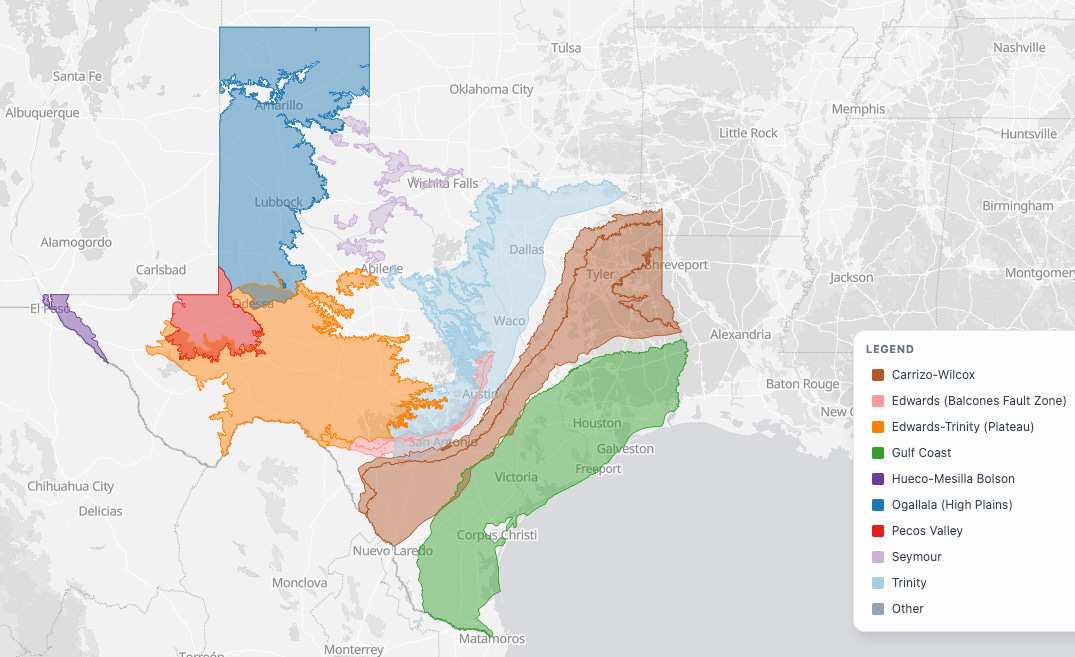
Here’s a map of the aquifers in Texas.
That’s all for this one….if you’re looking for a good book, Cadillac Desert is an amazing account of how water was brought to the west.
Sources:
Here are some great GIS maps from the state:
U.S. Geological Survey, Water-level and recoverable water in storage changes, High Plains aquifer, predevelopment to 2019 (Scientific Investigations Report 2023–5143) — how much water is in the aquifer, how much has been taken, and how far it stretches.
Kansas State University, Ogallala Aquifer — how fast it refills, and how little of what we pump gets replaced.
USDA Climate Hubs, Impacts to the Ogallala Aquifer — when farmers started pumping it, and why it accelerated.
Texas Water Development Board, Ogallala Aquifer — what’s left under the Texas Panhandle.
The aquifer outline on the map comes from USGS Data Series 543, digitized from Cederstrand and Becker, Open-File Report 99-267. Public domain.