
Does AI know where Texas farmland is?
How well does an AI model identify farmland?

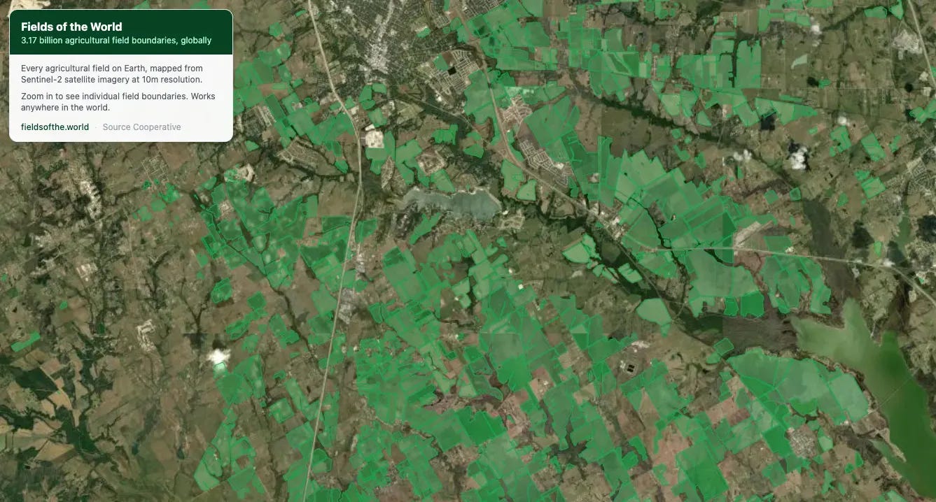
https://themap.io/maps/explore/fields-of-the-world
If you want to know where farmland is across the world, This is Fields of the World — a dataset released by Taylor Geospatial, Microsoft AI for Good, and Arizona State University that delineates every agricultural field boundary on earth in 241 countries.
This is an AI model. It was fed labeled satellite farm data. Then trained and run on every parcel on earth to generate an educated guess on where farmland is across the world. So it’s not literally farmland across the world, it’s an AI guess at where farmland is across the world.
It’s a fascinating dataset for food insecurity, farmers and supply chains.
Who Made This
Taylor Geospatial Engine — funded the infrastructure and assembled the collaboration
Dr. Hannah Kerner’s lab at ASU — built the original benchmark dataset
Microsoft AI for Good — contributed AI/ML expertise (Caleb Robinson)
Washington University in St. Louis — Nathan Jacobs’ computer vision lab
Wherobots — scaled the model to production
Open Data, Open Tools
The entire dataset is hosted on Source Cooperative under CC-BY licensing. The model weights are on Hugging Face. The code is on GitHub. You can run your own inference on any Sentinel-2 scene using the ftw-tools Python package.
Amazing work that is completely open.